Lake Michigan Beaches
ALLEGAN COUNTY
DOUGLAS
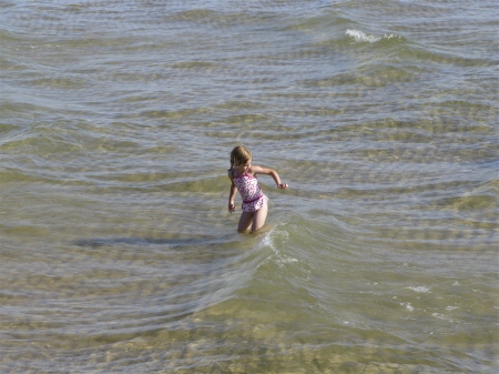
Douglas Beach
Lakeshore Drive, head west on Center Street, turn right on Lakeshore Drive.
Douglas, MI 49406
GPS: 42˚38.625’N - 86˚13.559’W
Free limited parking, restrooms, stairway access to beachDouglas Beach - Satellite Map and DirectionsFind a Bed & Breakfast near the beach in Douglas or nearby Saugatuck.
GANGES TOWNSHIP
Pier Cove Beach
70th Avenue, ½ mile west of I-196 exit 34, on124th Avenue, then drive south on Lakeshore Drive
Ganges Township, MI
GPS: 42˚35.170’N - 86˚13.590’W
Limited free parking, stairway access to small sandy beach, picnic area
Pier Cove Beach - Satellite Map and DirectionsWest Side County Park Beach
2152 Lakeshore Drive, south of M-89 & Saugatuck
Ganges Township, MI
Vehicle entrance fee. Walk to the beach through West Side Park, which has restrooms, picnic tables, playground, grills, baseball diamond. Stairway access to beach.
West Side County Park Beach - Satellite Map and Directions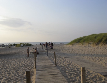
116th Avenue Road End Beach
I-196 exit 30, SW on Blue Star Highway, then drive north one mile on 70th to 116th Street.
Ganges Township, MI
GPS: 42˚39.855’N - 86˚12.913’W
Parking available for only one car. Beach access via a steep path down a bluff. No facilities.
116th Avenue Road End Beach - Satellite Map and Directions121st Avenue Road End Access
I-196 exit 34, west on124th Street, then drive south on Lakeshore Drive and 70th Avenue (south of West County Park)
Ganges Township, MI
GPS: 42˚39.855’N - 86˚12.913’W
Makeshift parking. Lake access only via short, flat sandy path. No facilities.
A recent lawsuit prohibits use to lake access only. Canoes and kayaks can easily be carried to the beach.
121th Avenue Road End Access - Satellite Map and Directions
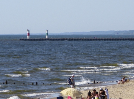
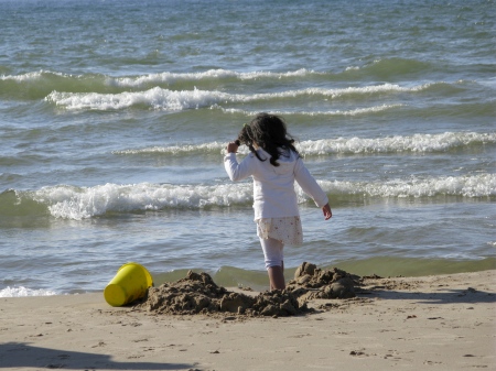
Kalamazoo River Pierhead Lights from Oval Beach
SAUGATUCK
Check out conditions on the Kalamazoo River with the Saugatuck webcam at the Butler Restaurant.
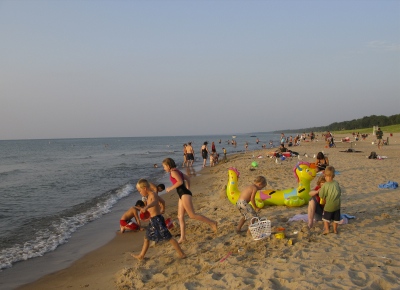
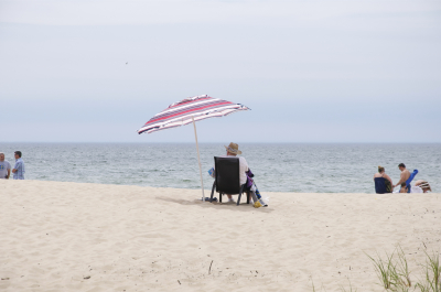
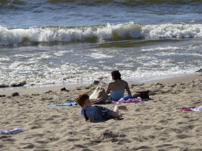
Oval Beach
Perryman Street & Oval Drive
Saugatuck, MI 49453
269-857-1701
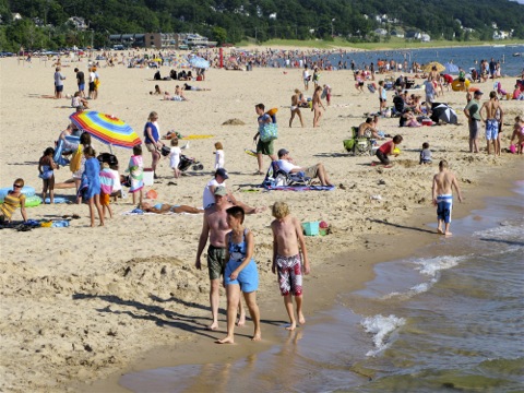
Ranked one of the Top 5 Most Beautiful Beaches in the U.S. by MTV
“One of the 25 best shorelines in the world” Conde Naste’s Traveler Magazine
Parking fee, restrooms, food, limited number of picnic tables and grills, showers, sand dunes, playground, walk along the beach to the 550-foot pier and view the pierhead lights and boat traffic entering and leaving the Kalamazoo River. Favorite local spot for sunset watching.
Adjacent to the 173-acre Saugatuck Harbor Natural Area with 3650 feet of additional Lake Michigan shoreline.
Oval Beach - Satellite Map and DirectionsSaugatuck Dunes State Park
64th & 138th Avenue
Saugatuck, MI 49453
269-637-2788
Day use park, Michigan State Park parking fee, hike 0.6 mile through woodlands to reach the freshwater coastal dune beach, 1000-acre park with 2.5 miles of Lake Michigan beach
Saugatuck Dunes State Park - Satellite Map and Directions
BERRIEN COUNTY
BENTON HARBOR
Jean Klock Park Beach
Klock Road Exit on M-63
Benton Harbor, MI
GPS: 42˚07.546’N - 86˚28.245’W
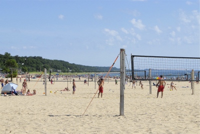
Parking fee, restrooms, beach boardwalk, food, playground, picnic pavilion, bathhouse, volleyball, observation tower
Jean Klock Park Beach - Satellite Map and DirectionsRocky Gap County Park Beach
Blue Star Highway
Benton Township, MI
269-983-7111, ext. 8435
GPS: 42˚08.047’N - 86˚27.975’W
Parking for 25 cars, stairway access to beach, picnic tables, playground
Rocky Gap County Park Beach - Satellite Map and Directions
BRIDGMAN
Weko Beach
5239 Lake Street
Bridgman, MI 49106
I-94 to Exit 16. Take Red Arrow Highway north to first traffic light (Lake Street). Turn left on Lake Street and continue to Weko Beach.
269-465-3406
GPS: 41˚56.509’N - 86˚34.881’W
$7.00 daily beach pass per car, restrooms, food, playground, sidewalk access to beach, picnic tables, beach boardwalk, volleyball, outdoor showers
Weko Beach Park - Satellite Map and Directions
HAGAR TOWNSHIP - HAGAR SHORES
Hagar Park Beach
I-196 to exit 7, Hagar Shore Road west 0.2 miles to the end of the road, then turn south (left) on M-63 and drive 1.5 miles.
Hagar Township, MI 49084
269-849-0455
GPS: 42˚00.520’N - 86˚32.940’W
Paved parking, walkway to beach, porta-johns, picnic tables, children's slides
Hagar Park Beach - Satellite Map and Directions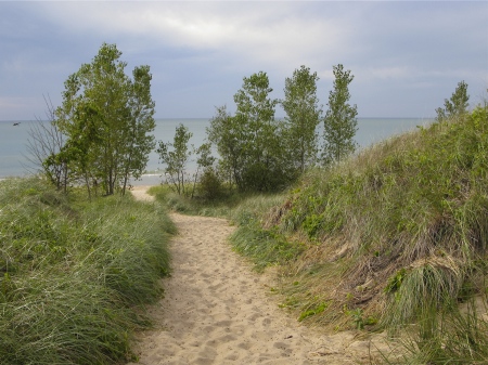
Roadside Park Beach
From I-196 Exit 7, take Hagar Shore Rd West to end (.2 mi). Turn right (North) onto M-63/Blue Star Hwy (.5 mi).
Hagar Township, MI 49084
269-849-0455
GPS: 42° 14' 14.78" N - 86° 22' 0.20" W
Free parking, picnic tables, restrooms, pathway to beach
Roadside Park Beach - Satellite Map and Directions
HARBERT
Harbert Road End Beach
Harbert Road
Harbert, MI 49115
GPS: 41˚52.273’N - 86˚38.717’W
Limited street parking on Harbert Road, stairway access to beach
Harbert Road End Beach - Satellite Map and Directions
LAKESIDE
Pier Street Beach
Pier Street
Lakeside, MI 49116
I-94 to Exit 6 Union Pier. Union Pier Road west to stoplight. Turn right on Red Arrow Highway, drive for 1 mile.
GPS: 41˚51.103’N - 86˚36.070’W
Limited street parking, used primarily by local residents
Pier Street Road End Beach - Satellite Map and Directions
NEW BUFFALO
New Buffalo Beach
Intersection of US 12 & Whitaker Street, turn north on Whitaker Street and drive to where the street ends
New Buffalo, MI 49117
GPS: 41˚47.992’ - 86˚44.867’W
Parking fee, food, restrooms, beach boardwalk, playground, lifeguards, picnic tables
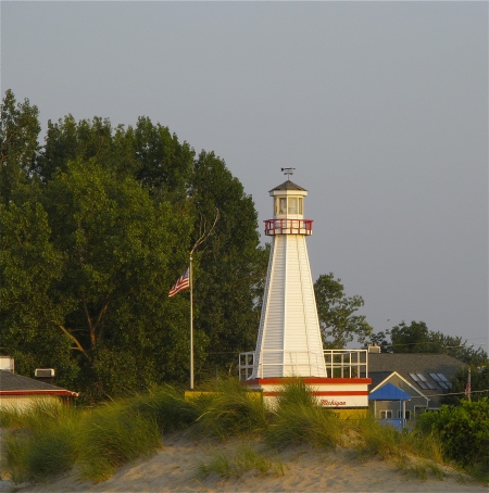
New Buffalo City Beach & Lakefront Park - Satellite Map and Directions1st New Buffalo Light Replica at the Beach
ST. JOSEPH
Check out current conditions at the beach with the St. Joe Lighthouse webcam or the Silver Beach webcam.
Lions Park Beach
1701 Lions Park Drive
St. Joseph, MI 49085
No entrance fee, playground, picnic pavilion, BBQ, beach access via the John & Dede Howard Recreation Trail.
Lions Park Beach - Satellite Map and DirectionsSilver Beach County Park
101 Broad Street
St. Joseph, MI 49085
269-982-0533
GPS: 42˚06.612’N - 86˚29.257’W
Parking fee, food, pier fishing, restrooms, playground, activities, showers, sidewalk access to beach, view of lighthouse, volleyball, summer outdoor concerts
Silver Beach County Park - Satellite Map and DirectionsSt. Joseph Lights
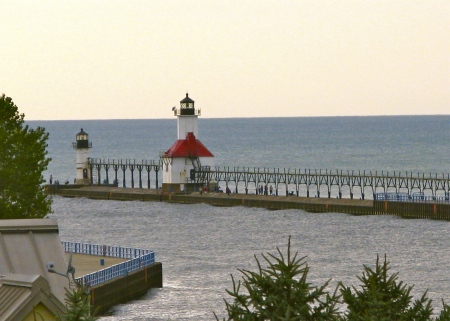
Tiscornia Beach
80 Ridgeway Street
St. Joseph, MI 49085
GPS: 42˚06.924’N - 86˚29.273’W
Parking fee, restrooms, food, picnic area, access to North Pier lights, sidewalk access to beach, pavilion, changing rooms. Stroll out 1800 feet on the North Pier to see the lights.
Tiscornia Park Beach - Satellite Map and Directions
SAWYER
Warren Dunes Beach
Warren Dunes State Park
12032 Red Arrow Highway
Sawyer, MI 49125
269-426-4013
GPS: 41˚54.103’N - 86˚36.070’W
Three parking lots, parking fee, food, restrooms, sidewalk access to beach, hiking trails, dunes, picnic tables, playground, changing rooms, volleyball, showers
Warren Dunes State Park Beach - Satellite Map and Directions
STEVENSVILLE
Glenlord Beach
3000 W. Glenlord Road, 1 mile west of Red Arrow Highway
Stevensville, MI 49027
GPS: 42˚02.606’N - 86˚31.576’W
No entrance fee, parking, restrooms, picnic area, observation decks on bluff, erosion prevents access to beach.
Glenlord Beach - Satellite Map and DirectionsGrand Mere State Park Beach
Off Thornton Drive at the end of Grand Mere Road
I-94 to Exit 22. Or turn west off Red Arrow Highway on Grand Mere Road (John Beers Road)
Stevensville, MI 49127
GPS: 42˚00.520’N - 86˚32.940’W
Parking fee, restrooms located ½ mile away at North Lake Park, picnic area, fishing.
Grand Mere State Park Beach - Satellite Map and DirectionsLincoln Township Beach
5450 Notre Dame Avenue
Stevensville, MI 49127
GPS: 42˚01.180’N - 86˚32.915’W
Parking, porta-johns, picnic area, fishing
Lincoln Township Beach - Satellite Map and Directions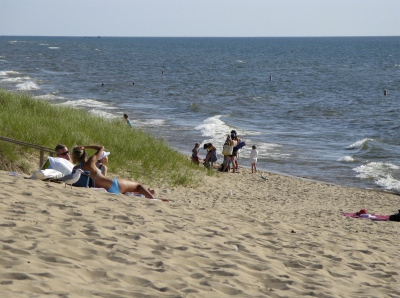
UNION PIER
McKinley Road End Beach
McKinley Road
Union Pier, MI 49129
GPS: 41˚49.881’N - 86˚41.798’W
Limited street parking, small park, trail and stairway access to beach, used primarily by local residents
McKinley Road End Beach - Satellite Map and DirectionsTownline Road Beach
Townline Road
Union Pier, MI 49129
GPS: 41˚49.693’N - 86˚42.237’W
Limited street parking, stairway access to beach, used primarily by local residents
Townline Road Beach - Satellite Map and DirectionsUnion Pier Beach
End of Berrien Street at Lakeshore Road
Union Pier, MI 49129
Limited street parking; public beach located at the opening of the wooden fence left of the fire hydrant
Union Pier Beach - Satellite Map and Directions
MUSKEGON COUNTY
MONTAGUE - WHITEHALL - WHITE LAKE
Duck Lake State Park
4731 North Scenic Drive
Whitehall, MI 49445
231-744-3480
GPS: 43˚20.556’N – 86˚24.474W
Parking fee, Lake Michigan and Duck Lake shoreline; 728 acre day-use park, restrooms, picnic tables, hiking, fishing, sand dunes.
Duck Lake State Park Beach - Satellite Map and DirectionsWhite River Light Station
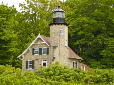
Check out the White River Light Station tower webcam
to see current conditions on Lake Michigan and the White Lake Channel.
White River Light Station Beach
6199 Murray Road
Whitehall, MI 49461
GPS: 43.374430N, -86.425803W
Bear left at the end of Murray Road and follow signs to the White River Light Station Museum. Free parking in the museum lot. Walk along the channel to the beach on Lake Michigan or stroll out on the pier.
150 ft of Lake Michigan shoreline, no lifeguard (swim at own risk) or facilities on the beach, though there is a bathroom available at the museum. Day use only. Fishing allowed off the pier and the channel walkway.
White River Light Station Beach - Satellite Map and Directions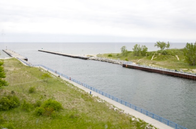
Medbery Park Beach
7290 Lifeguard Road
Montague, MI 49437
GPS: 43.375873 N, -86.425163W
Take W. Old Channel Trail to Lau Road then bear right at the fork onto Lifeguard Road. On the White Lake channel into Lake Michigan across from the White Lake Light Station Museum.
Free parking, 600 ft of Lake Michigan shoreline, small picnic area, park benches on the channel, restrooms (no running water), no lifeguard (swim at own risk), day use only (6am-11pm). Fishing allowed off the pier and the channel walkway.
Medbery Park Beach - Satellite Map and DirectionsMeinert Park Beach
Pines Campground
8390 Meinert Road
Montague, MI 49437
231-894-4881
GPS: 43˚27.552’N – 86˚27.395W
Entry fee, 88 acres of rolling dunes, large sandy beach, restrooms, playgrounds, food, picnic shelter, 67 campground sites, rental cottage, views of Lake Michigan & Little Flower Creek. Wheelchair accessible viewing platform.
Meinert Park Beach - Satellite Map and Directions
MUSKEGON
Check out current conditions at the beach with the Muskegon Lighthouse webcams.
Norman F. Kruse Park Beach
Beach Street & West Sherman Boulevard
Muskegon, MI 49443
231-724-6704
GPS: 43˚12.315’N – 86˚19.231W
Free parking, restrooms, picnic shelters, beach and dunes accessible by ramp, playground, basketball court, nature trails, 1 mile of Lake Michigan shoreline, dog beach located at the northern part of the park.
- The County’s Only Dog Friendly Beach -
Norman F. Kruse Park Beach - Satellite Map and Directions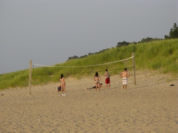
Lake Michigan Park Beach
Lake Michigan shoreline and dunes between Sherman Blvd & Lakeshore Dr
Muskegon, MI 49441
Narrow beaches and high, steep dunes in a natural state - no power or restrooms. Beach Street walkway connects with other beach parks in the area (Pere Marquette and Kruse).
Lake Michigan Park Beach - Satellite Map and DirectionsMuskegon State Park
3560 Memorial Drive
North Muskegon, MI 49445
231-744-3480
GPS: 43˚14.196’N – 86˚20.494W
Entry fee, parking; 1165 acres including Lake Michigan and Muskegon Lake, restrooms, picnic tables, campground, hiking, fishing, boat launch, ice fishing, metal detecting area, lighted cross-country ski trails.
Muskegon State Park Beach - Satellite Map and DirectionsMuskegon Pier Light in Winter
from Pere Marquette Park Beach
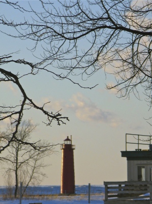
Pere Marquette Park Beach
1601 Beach Street at Lakeshore Drive
Muskegon, MI 49441
231-724-6704
GPS: 43˚13.458’N – 86˚20.172W
No entry fee, city park, restrooms, playground, restaurant and bar, volleyball, access to lighthouse and channel, handicapped walkway to beach.
Pere Marquette Park Beach - Satellite Map and DirectionsPioneer County Park Beach
1563 N. Scenic Drive at Orshal
Muskegon, MI 49445
231-744-3580
Entry fee, 145 acre park, 2000 feet of white sandy beach, 213 campsites, playground, lodge, picnic tables, volleyball, tennis, baseball, basketball, horseshoe pit. Close to Michigan Adventure amusement park, approx. 1 mile north of Muskegon State Park.
Pioneer County Park Beach - Satellite Map and Directions
NORTON SHORES
Lake Harbor Park Beach
4635 Lake Harbor Road
Norton Shores, MI 49441
231-798-3711
GPS: 43˚07.994’N – 86˚15.959W
Day use park (5am-10pm), 189 acre city park, 4000 feet of Lake Michigan shoreline. No lifeguards, swim at own risk. Picnic area overlooking the Mona Lake channel with tables, grills, shelter and restrooms. Scenic deck overlooking the channel.
Lake Harbor Park Beach - Satellite Map and DirectionsPJ Hoffmaster State Park Beach
6585 Lake Harbor Road
Norton Shores, MI 49441
231-798-3711
GPS: 43˚07.994’N – 86˚15.959W
Parking fee, 1100 acres of forested dunes, 3 miles of Lake Michigan shoreline; Gillette Visitor Center, restrooms, picnic areas, hiking trails, campground.
PJ Hoffmaster State Park Beach - Satellite Map and Directions
OTTAWA COUNTY
FERRYSBURG
North Beach Park
18775 North Shore Drive. (2 miles north of Grand Haven.)
Ferrysburg, MI 49409
Take Ferrysburg exit off US 31, drive west on 3rd Street to North Shore Drive. Turn west on North Shore Drive. Two miles to park entrance
616-738-4810
GPS: 43˚04.908’N – 86˚15.136W
Parking fee, 7 acre park, restrooms, vending machines, playground, picnic tables, grills, volleyball, beach walk accessible by wheelchair, deck overlooking the dune, shelters.
North Beach Park - Satellite Map and Directions
GRAND HAVEN
Check out conditions on Lake Michigan and at the beach with the Grand Haven Steelheaders webcam or the SurfGrandHaven webcam.
Grand Haven City Beach
South Harbor Drive
Grand Haven, MI 49417
616-842-3210
GPS: 43˚03.072’N – 86˚14.683W
Parking lot, other facilities available at nearby State Park.
Grand Haven City Beach - Satellite Map and DirectionsGrand Haven Lights from Grand Haven State Park
Grand Haven State Park
1001 Harbor Avenue
Grand Haven, MI 49417
616-847-1309
GPS: 43˚03.369’N – 86˚14.871W
Parking fee, playground, concession stand, beachhouse, restrooms, picnic area, pure sand beach, campground, lighthouse, fishing off lighthouse pier or breakwater. Take Harbor Trolley bus from downtown to avoid parking difficulties during high season.
Grand Haven State Park - Satellite Map and DirectionsRosy Mound Natural Area
13925 Lakeshore Avenue
Grand Haven, MI 49417
(From US 31 - turn west on Rosy Mound Drive, then south on Lakeshore Avenue. Drive to park entrance which will be on the west side of the road.)
616-738-4810
Parking fee, 164 acre park, parking lot restrooms, pit toilets near beach, picnic tables, grills, shade canopy near beach, hiking trails to Lake Michigan, dune boardwalk trail. Access to beach via stairway and high wooded dune system may be strenuous. However some trails are wheelchair accessible.
Rosy Mound Natural Area - Satellite Map and Directions
HOLLAND
Check out conditions on Lake Michigan and the Holland channel with the Spyglass Condos webcam or Lake Macatawa with the Boatwerks Restaurant webcam.
Holland State Park Beach
2215 Ottawa Beach Road
Holland, MI 49424
616-399-9390
Parking fee, food, showers, restrooms, picnic tables, fishing off pier. Walk along the boardwalk on the north side of the Black River channel for views of Holland's iconic "Big Red" Lighthouse, the most photographed lighthouse in Michigan. Stroll over 1000 feet to the end of the arrowhead breakwater pier for views of the beach, the pierhead lights, and boats entering and leaving the harbor. Very popular spot for sunset watching.
Holland State Park Beach - Satellite Map and DirectionsJames Street Beach
James Street, west of Lakefront Drive, 7 miles west of Holland
Holland, MI 49424
GPS: 42˚47.882’N – 86˚12.405W
Limited parking, residential area
James Street Beach - Satellite Map and DirectionsLaketown Park Beach
6710 142nd Avenue (bet. Saugatuck & Holland, west off 64th Street)
Holland, MI
616-335-3050
Limited free parking, access to beach via long stairway.
Laketown Park Beach - Satellite Map and DirectionsTunnel Park Beach
Lakeshore Drive & Perry
Holland, MI 49424
616-738-4810
Parking fee, but free nearby street parking available too; restrooms, food, changing rooms, playground, volleyball, picnic tables, shelters, dunes
Tunnel Park Beach - Satellite Map and Directions
WEST OLIVE
Kirk Park Beach
9791 Lakeshore Avenue, 2 miles south of Lake Michigan Drive (M-45)
West Olive, MI 49460-9553
616-846-8117
GPS: 42˚59.180’N – 86˚13.475W
Parking fee, restrooms, playground, concession stand, hiking trails, picnic pavilion, grills, dune overlooks, paved path to beach, horseshoe pit, park lodge
Kirk Park Beach - Satellite Map and Directions
VAN BUREN COUNTY
COVERT
Covert Park Beach
80559 32nd Avenue
Covert, MI 49043
I-196 to Exit 13 (Covert). Turn left at the bottom of ramp and cross under the interstate. Pass through the first stop sign and continue straight ahead until you reach Covert Park.
269-769-1421
Parking, $6 day pass, picnic tables, grills, pavilion, bathhouse, outdoor shower, walk through woods to reach 1/4 mile beachfront.
Covert Township Park Beach - Satellite Map and Directions
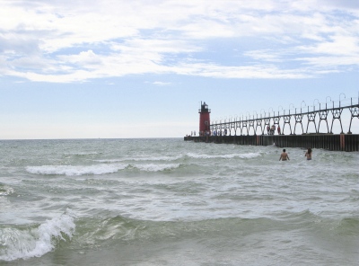
SOUTH HAVEN
Check out current conditions at the beach with the South Haven Lighthouse webcams.
Dyckman Beach
175 North Shore Drive at the end of Dyckman
South Haven, MI 49090
269-637-0726
Parking fee, grills, picnic tables, deck overlooking the lake
Dyckman Beach - Satellite Map and DirectionsNewcome Beach
Newcome Street off 725 North Shore Drive just south of Baseline Road
South Haven, MI 49090
Street parking, secluded public beach, deck overlooking the lake, grills and picnic tables, no restrooms
Newcome Beach Access - Satellite Map and DirectionsNorth Beach
45 Lakeshore Drive off North Shore - between Grand Chicago & Avery
South Haven, MI 49090
269-637-0726
Parking fee, restrooms, food, fishing from pier, volleyball. Stroll on the 850-foot pier to the pierhead light at the end and watch the boat traffic coming in and out of the river. The red lighthouse is right across the channel on the south pier.
North Beach - Satellite Map and DirectionsOak Street Beach
375 North Shore Drive, ½ mile away from North Beach
South Haven, MI 49090
Free parking, stairway access to beach, secluded public beach, no restrooms or other facilities
Oak Street Beach - Satellite Map and DirectionsPackard Park Beach
231 North Shore Drive – between Dyckman Avenue & Wells Street
South Haven, MI 49090
269-637-0726
Parking fee, picnic area, playground, sidewalk access to beach, observation deck
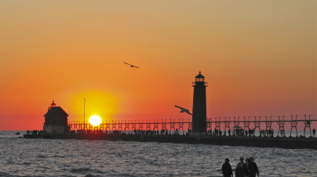
Packard Park Beach - Satellite Map and DirectionsSouth Haven Light from South Beach
South Beach
Take Phoenix Street through downtown South Haven. Will end at Water Street and the beach.
60 Water Street
South Haven, MI 49090
269-637-0726
Parking fee, sidewalk access to beach, food, playground, picnic tables, restrooms, fishing, skateboard park. Stroll on the 850-foot pier to the picturesque red lighthouse at the end and watch the boat traffic coming in and out of the river. South Haven’s most popular beach.
South Beach - Satellite Map and DirectionsVan Buren State Park Beach
23960 Ruggles Road
South Haven, MI 49090
269-637-2788
I-196 exit 18, north on M-140 for 1/10th mile, then drive west on 14th Avenue for 7/10th of a mile, then south on Blue Star Highway for 1.4 miles. Turn at Ruggles Road entrance to Van Buren State Park.
GPS: 42.3362˚N – 86.3028˚W
Parking fee, playground, hiking trails, picnic pavilion
Van Buren State Park Beach - Satellite Map and DirectionsWoodman Street Beach
Woodman Street near 100 North Shore Drive
South Haven, MI 49090
Grills, picnic tables, deck overlooking Lake Michigan
Woodman Street Beach - Satellite Map and Directions
Unless otherwise indicated, all Lake Effect Living photographs are the work and property of Sharon Pisacreta.